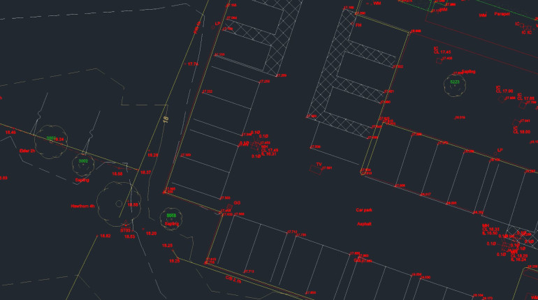
Topographical drawing and Revit modelling.
This project was a hybrid project consisting of modelling the hard surfaces in Revit and using Total Station data from the client in the soft areas.
The soft area's from the Total Stations were processed into an AutoCAD topo drawing - this was then exported using our in-house AutoCAD plugin to a Revit compatible Topo Surface file which was imported into Revit to create an accurate topo surface with contours.
The hard areas were modelled in Revit from point cloud data. This was then exported into the soft areas topo drawing to complete the drawing.
Using a hybrid approach ensures that the soft areas have the correct ground levels (especially where there is large amount of overgrowth) and ensured the topo drawing and Revit models both match up perfectly.